Be in the Room Where It Happens
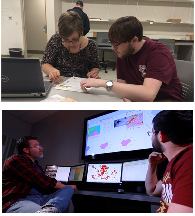
Archaeology students and faculty have a wide array of resources to work with, creating a rich hands-on, research-driven educational experience. Our active research projects – focused on the Lowcountry and around the world conducted by both faculty and students – are facilitated via our research centers, laboratory spaces, equipment and close collaborations with our partners in cognate disciplines.
Tools, Toys, and Centers of Discovery
-
Center for Historical Landscapes
 The Center for Historical Landscapes (CHiL) is a research hub that focuses on the impacts of human and environmental change over the long expanse of human history. Its goal is to empower discussions related to:
 - heritage, environmental and land management,
- economic development, and
- responses to dramatic climatic fluctuations and change.
CHiL is a gathering space of expertise from a wide array of disciplines, such as archaeology, anthropology, history, classics, geology, informatics, urban planning, climatology and the environmental sciences. Its research initiatives are found in the Carolina Lowcountry and around the world. Learn more about CHiL -
Center for Social Science Research
 The Center for Social Science Research (CSSR) is a research facility to facilitate all inquiries related to the social sciences and humanities. In the CSSR, you’ll collaborate with faculty and students on research in the humanities and social sciences.
As an archaeology student, you can access the CSSR’s research lab for archaeological materials analysis and a computing lab optimized for geospatial, quantitative and 3D visualizations and data management.
Learn more about the CSSR -
Other Tools and Toys
In addition to the CSSR and CHiL, the Archaeology Program maintains equipment for photogrammetry and low altitude drone survey and a dedicated server for data storage and dissemination.
-
Our Partners

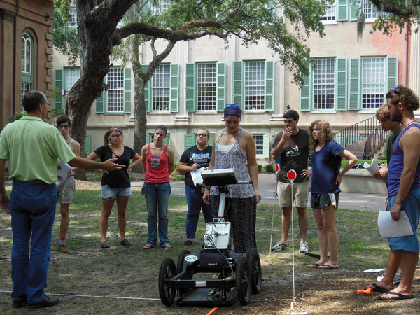
Students test out ground penetrating radar on the Cistern. As an interdisciplinary program, archaeology benefits from partnerships with other departments and resources:
- The Anthropology Program maintains a full set of excavation equipment for projects conducted in the Carolina Lowcountry.
- The Coastal and Marine Geology group within the Department of Geology houses facilities and equipment used to understand archaeological sites on both the land and seafloor. Faculty and students from several departments use the departmental vessel with side-scan sonar, a high-resolution chirp sub-bottom, drones, an autonomous surface vessel, real-time kinematic GPS and various navigation and processing software. On land we use ground penetrating radar, vibracores, magnetic gradiometers, electrical resistivity, satellite remote sensing and various other techniques to build an understanding of various sites.
- The Santee-Cooper GIS Laboratory (SCGIS) supports undergraduate, graduate and faculty teaching and research at the College in GIS, remote sensing or geologic/environmental modeling/computing.
Related Events

feb
21
Choose Charleston: A Place Like No Other

feb
19
Romeo and Juliet by William Shakespeare

feb
19
Romeo and Juliet by William Shakespeare